Topographical & Drone Survey
Topographical & Drone Survey
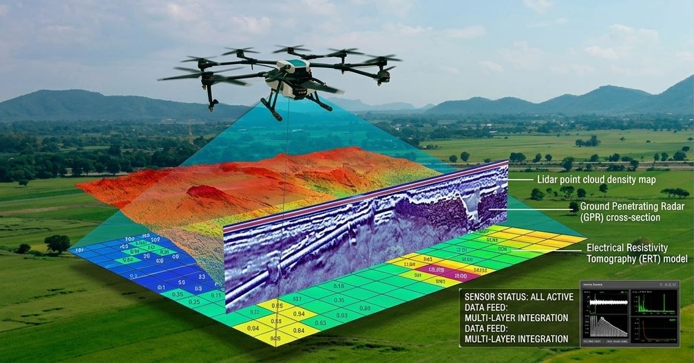
Topographical & Drone Survey provides accurate mapping and detailed analysis of land features using advanced surveying techniques and aerial drone technology. It captures high-resolution data on terrain, elevation, contours, and existing structures, enabling precise planning and design. This modern approach ensures faster data collection, improved accuracy, and better visualization for engineering, construction, and land development projects.
Key Points:
- High-precision land mapping & contour generation
- Drone-based aerial surveys for large areas
- Accurate elevation and terrain analysis
- Fast and cost-effective data collection
- 3D models and digital mapping outputs
- Ideal for construction, infrastructure & planning
- Reduces manual survey time and errors